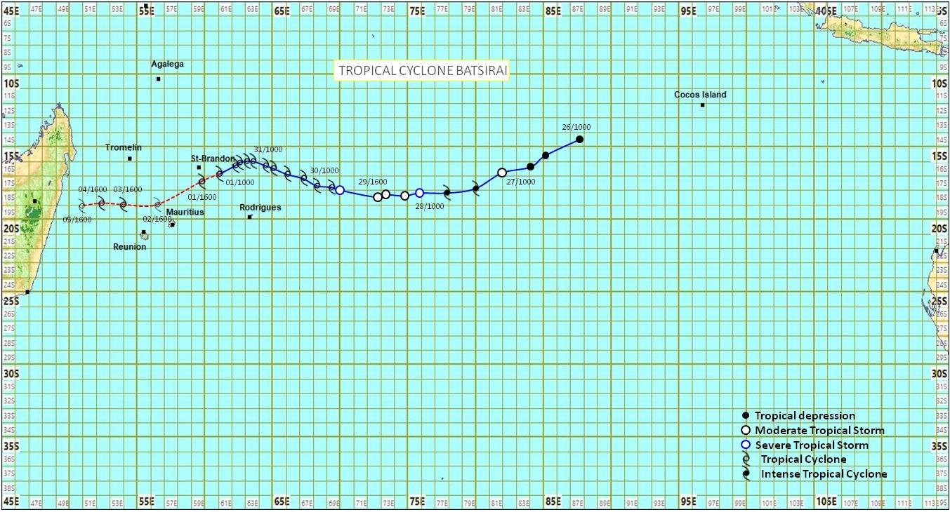
Fifth cyclone bulletin for Mauritius issued at 1010 hours on Tuesday 01 February 2022.
Fifth cyclone bulletin: A cyclone warning class II is in force in Mauritius


Tropical cyclone Batsirai has again moved in an enviroment more favourable for further intensification. Over the past six hours a slight acceleration and recurvature towards the south-west has been observed. The estimated central pressure of the tropical cyclone is around 965 hPa and the estimated wind gust near the centre is around 200 km/h.
At 1000 hours this morning, tropical cyclone Batsirai was centred at about 480 km to the north-east of Mauritius, in latitude 16.9 degrees South and longitude 61.1 degrees East. It has moved in a general west-south-west direction at about 15 km/h over the past 24 hours.
On this trajectory, tropical cyclone Batsirai continues to approach Mauritius and represents a potential threat to the island. Latest observations confirm the risk of further recurvature of the trajectory towards the south-west which will bring the centre closer to Mauritius.
A cyclone warning class II is in force in Mauritius
The public in Mauritius is advised to complete all preliminary precautions.
The weather will be cloudy with passing showers mainly to the east, the south and the central plateau, more frequent in the afternoon. A marked deterioration of the weather is expected by this evening.
Wind will blow from the south-east at a speed of about 45 km/h with gusts of the order of 90 km/h in exposed areas. The wind will strengthen further tonight to reach gusts of the order of 100 km/h.
The sea will be very rough with swells of 5 metres. The public is advised not to venture at sea.
A cyclone warning class II is in force in Mauritius
A cyclone warning class II is in force in Mauritius
The next bulletin will be issued at around 1610 hours.


